
Charleston Shark Teeth Hunting, the fossil trips LowCountry Coastal Excursions runs from Shem Creek in Mount Pleasant, teaches beginners one method: arrive on a falling tide, search the shell lines and gravel patches the water has just uncovered, and look for a small glossy triangle with a duller root. Timing and where you look matter more than luck or gear.
Shark tooth hunting rewards method more than luck. Go while the tide is falling, search the bands of shell and gravel the water has just left behind, and train your eye for a small, glossy triangle sitting on a duller root. Charleston Shark Teeth Hunting, the fossil trips LowCountry Coastal Excursions runs out of Mount Pleasant, South Carolina, teaches exactly that on the beach, and this is the same lesson written down for anyone starting out, wherever your coast happens to be.
Key takeaways
- Tide decides the day. Low water exposes more beach, and in Charleston NOAA puts the mean range of tide at 5.22 feet, so a lot of ground appears and disappears twice a day.
- The biggest swings arrive around the new and full moon. In NOAA's October 2026 predictions for Charleston, the lowest low of the month is about 1.7 feet lower than the neap-tide lows around the first quarter.
- Teeth settle with the heavy material: shell lines, gravel patches, dark phosphate grains and the lip of a small drop-off at the water's edge.
- A sifter with quarter-inch holes is the one tool worth buying. In South Carolina, keep it on the exposed beach; below mean low tide even a Hobby License allows hand collection only.
- Beginners find small teeth. Sand tiger, mako, lemon and bull shark teeth are the regulars on our tour page, and a big tooth is the exception you hope for, not the plan.
When to go: the falling tide, not the clock
The single most useful thing a beginner can do costs nothing: look up the tide before you look up anything else. The reason is simple enough that geologists put it in one line. The Maryland Geological Survey, writing about its own famous fossil coast, says collecting is best at low tide and after storms, and explains that low tide is the best time to look for fossils along the beach because more beach is exposed.
"Low tide is the best time to look for fossils along the beach because more beach is exposed."— Maryland Geological Survey, Fossil Collecting Sites at Calvert Cliffs
How much more beach depends on where you are, and this is where the Lowcountry is unusual. NOAA's tidal datums for the Charleston station give a mean range of tide of 5.22 feet, measured over the 1983 to 2001 epoch. That is a lot of vertical water moving over a gently sloping beach twice a day, and it means the strip of sand you can search at low water is far wider than the one you see at high water.
The range is not the same every day, and the difference is worth planning around. In NOAA's predictions for Charleston Harbor for October 2026, the biggest swings of the month cluster around the new moon on October 10 and the full moon on October 26, with single tides approaching 7 feet between high and low water. Around the first quarter moon on October 18 and 19 the largest daily swing drops to about 3.8 feet. The lowest predicted low of the month, on October 28, sits about 1.7 feet below the lows of October 19. On a beach, that is the difference between a shell bed you can walk on and one you can only see through the water.
Three habits follow from that. Arrive while the tide is still falling, so you are working ground as it uncovers rather than ground that has been walked since dawn. Favor the days around a new or full moon when you have a choice. And treat the days after a storm or a hard blow as a bonus, because, as the Maryland survey puts it, the supply of shells and other fossils is replenished.
That is also how we schedule our own trips. The tour page says we time every departure around low tide, when the tooth-bearing layer is most exposed, which is why the shared morning trip leaves on a tide-driven schedule rather than a fixed one. The same page names October through January as the best season, when the tides run lowest, though teeth turn up year-round.
Where teeth collect on a beach
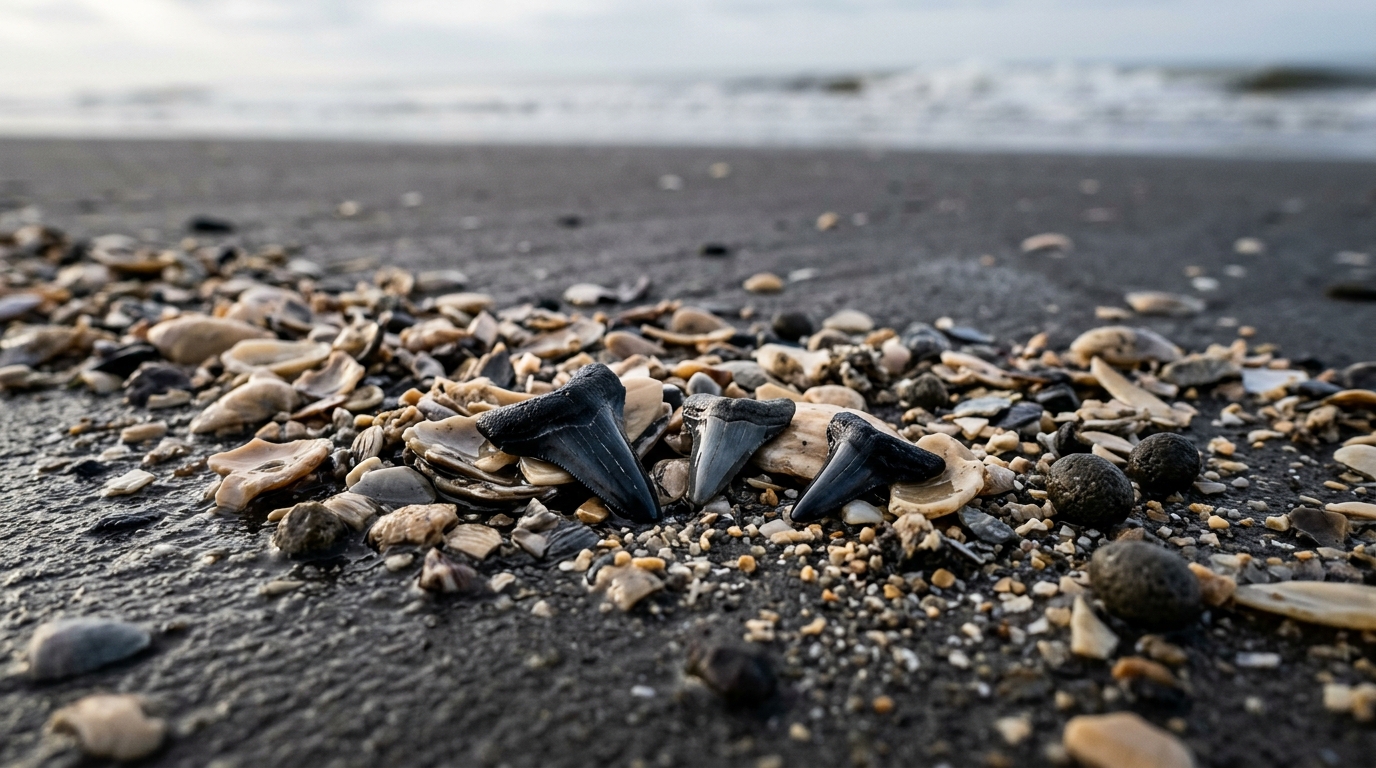
A beach sorts what the water brings it. Fine sand moves easily and keeps moving; heavier, chunkier material drops out first and piles up in lines and patches. Fossil teeth are small, dense and flat, and they tend to end up with that heavier crowd. So you are not searching a beach so much as searching the handful of places on it where the water has already done the sorting for you.
- The fresh shell line. The band of broken shell, called shell hash, that the falling tide has just left. Work the newest line nearest the water first; the high-tide line up the beach may already have been walked.
- Gravel and dark patches. Look for coarse, darker sand mixed into the beach. A Sarasota County hydrogeologist notes that those small black grains are phosphate and small particles of fossilized bone and teeth, which is why dark-sand beaches produce.
- The lip at the water's edge. Where small waves break there can be a short step down. Material piles at its base, and a gentle scoop there, on the exposed beach, turns up a lot of gravel quickly.
- Around anything that interrupts the flow: a sandbar edge, a runnel draining back to the sea, the downstream side of a shell pile.
On Morris Island, the barrier island we run to near Charleston, the captain reads which shell beds the last tide restocked before anybody starts looking. If you want the location side of that, which beaches and why, it lives in our guide to shark tooth hunting on Morris Island rather than here.
How to actually look
New hunters walk too fast and look too far ahead. Slow down, stand with the sun at your side rather than in your eyes, and scan a strip about a stride wide just in front of your feet. You are hunting for a shape and a shine, not for color alone. A tooth is a small triangle, and its blade is enameled, so when it is wet it throws a highlight that dull shell and pebble do not.
Then check the second clue before you get excited: a real tooth has two parts, the glossy blade and a duller, coarser root beneath it. Some of what looks right from standing height is a black shell chip or a water-worn phosphate pebble, and both are one material all the way through. Crouch, pick it up, look at it edge-on. After enough false alarms your eye starts filtering them out on its own, and that is the moment finds start coming quickly.
One habit worth adopting: keep your first confirmed tooth of the day in your hand or a separate pocket and use it as a reference. Comparing a candidate against a known tooth in the same light and the same wet sand settles more questions than any description can.
Gear: a sifter, a bag and shoes you can get wet
You can find teeth with nothing but your eyes, and plenty of people do. The one tool that changes a beginner's morning is a sifter. In Venice, Florida, the local advice from Sarasota County is that many people use a metal sifter with quarter-inch holes on the end of a handle. That mesh size lets sand wash through while shell, gravel and teeth stay on the screen, where they are far easier to see. The trade-off is that the very smallest teeth can slip through, a trade-off worth accepting.
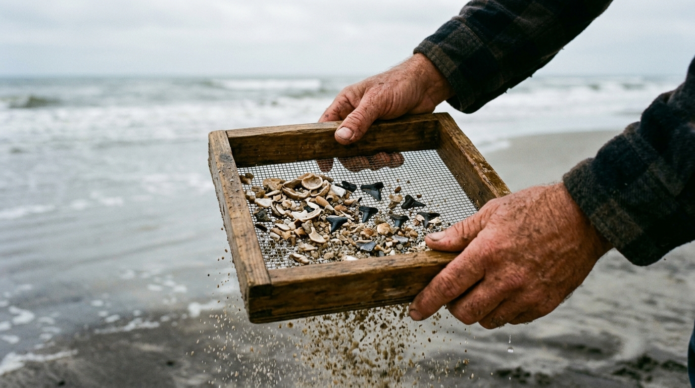
Where you use it is a legal question as well as a practical one, and the answer changes by state. In South Carolina, the method rules that come with a Hobby License apply below the mean low tide line, and they are strict: the Institute that issues the license says recovery must be by hand and must not involve mechanical devices or excavation. So use your sifter on the exposed beach, not on the bottom under the water. At Calvert Cliffs in Maryland, by contrast, the state park says sieves and shovels can be used to sift the sand for fossils on its beach, and in Venice the long-handled screen is sold at the pier.
The rest of the kit is short, and it is the list on our own tour page:
- Water shoes or sandals you can get wet; shell hash is sharp.
- Sunscreen, a hat and sunglasses. Barrier island beaches have no shade.
- A bag or container for your finds.
- Water and snacks.
- A towel and a change of clothes for the ride home.
On our trips the hunting gear is provided, so the list above is all you carry.
What a first morning really turns up
Honest expectations make for a better day. On our tour page the regular finds are sand tiger, mako, lemon and bull shark teeth, with megalodon listed for lucky days rather than promised. Our own Charleston guide puts the typical tooth at a quarter-inch to an inch, dark gray, black or tan. Alongside them come ray dental plates and pieces of fossil bone, which people often mistake for teeth at first.
As for quantity, the tour page's own figure is that most groups leave with 20 to 40 pieces, counting teeth, shells and fossils together. We would rather you arrive expecting a handful of small, perfect teeth and be pleased than arrive expecting a palm-sized tooth and feel cheated by a very good morning. Once you are home, sorting the bag by species is half the fun.
Large teeth do exist around Charleston. Our own guides note that large complete megalodon teeth are usually recovered by divers working the river bottoms, which is a different activity with a different rulebook, below the tide line and under a Hobby License. On the beach, the prize is more often a small tooth in perfect condition.
Charleston vs Venice vs Calvert Cliffs
Three well-known shark tooth coasts reward different habits. The tide figures below come from NOAA's October 2026 predictions for the nearest reference stations, averaged across every rise and fall in the month; the other rows cite the source named in each cell.
| Charleston area, SC | Venice, FL | Calvert Cliffs, MD | |
|---|---|---|---|
| Average tide swing | About 5.0 ft (Charleston Harbor station) | About 1.5 ft (Venice Municipal Airport station) | About 0.9 ft (Cove Point station) |
| Where the teeth come from | Oligocene beds such as the Chandler Bridge Formation, with younger material reworked above | Miocene Peace River Formation, 16 to 23 million years old, just offshore (Sarasota County) | Miocene deposits, 10 to 20 million years old, over 600 fossil species (Maryland DNR) |
| Getting onto the beach | Morris Island is boat access only | Public beaches south of the Venice Jetty (Visit Venice) | Beach about 1.8 miles on foot from the parking lot (Maryland DNR) |
| Sifting | On the exposed beach; hand collection only below mean low tide | Long-handled quarter-inch sifters sold locally (Sarasota County) | Sieves and shovels allowed on the beach (Maryland DNR) |
| Keeping shark teeth | Yes above mean low tide; Hobby License below it | Yes; Florida's fossil permit excludes shark and ray teeth (Florida Museum) | Yes from the open beach; illegal beneath the cliffs (Maryland DNR) |
| What it rewards | Timing the big tides | Working the water's edge | Arriving after a storm |
The practical lesson from the tide row: in Venice and on the Chesapeake the water moves far less, so the day turns on storms and on working the edge of the surf. Here, the tide is the whole plan. Arrive late on a big falling tide and the incoming water takes back shell bed you never got to; arrive on time and you are standing on ground that was underwater a few hours earlier.
Rules: what you can keep in South Carolina
For a beginner on a beach, the answer is almost always yes. South Carolina's Underwater Antiquities Act defines the territorial waters it governs as reaching up to, but not above, the line of mean low tide. A tooth you pick up off the exposed beach above that line is ordinary beachcombing, with no permit, fee or report involved.
Below that line, in creeks, rivers and the harbor bottom, fossils belong to the State and recovering them needs a Hobby License from the South Carolina Institute of Archaeology and Anthropology, with hand collection only and quarterly reporting. Federal ground is stricter still: on National Park Service land, such as Fort Sumter, collecting fossils is prohibited. Our collecting-laws guide, linked in the takeaways above, has the fees, the reporting rules and the sources in full.
Your first hour, step by step
- Check the tide table for the station nearest your beach and plan to arrive while the tide is still falling.
- Walk to the waterline first and find the newest shell line, not the old one at the top of the beach.
- Crouch and scan a stride-wide strip with the sun at your side, looking for a glossy triangle.
- Confirm your first find edge-on: blade on a root. Keep it as your reference.
- Move to the gravel patches and the lip at the water's edge, and sift there on the exposed beach.
- Follow the water down as it drops, and head back up the beach once the tide turns.
Going with a guide
Everything above works on a public beach, and if you have a free morning and a tide table, go and try it. Where a guided trip earns its place is access and time. Morris Island has no road, so without a boat you cannot reach it, and a captain who runs these beaches knows which stretch the last tide restocked. On ours, the captain teaches sifting technique on the sand and identifies every find on the spot.
| Detail | Figure |
|---|---|
| Price, shared boat | $125 per person |
| Duration | 3 to 4 hours |
| Departs | Mornings, timed to the tide (shared trip about 8:00 AM) |
| Group size aboard | Up to 23 guests |
| Gear | Provided |
| What you keep | Every tooth you find |
Who it is not for: anyone who wants a guaranteed big tooth. Nobody can promise that, and the tour page does not. We run rain or shine and cancel only for unsafe weather, and the boat boards in Mount Pleasant, about 14 minutes from downtown Charleston.
Pricing, BYOB rules, weather policy, and departure details are all on our FAQ page — or call (843) 874-8555.
Frequently Asked
What is the best time to go shark tooth hunting?
On a falling tide heading toward low water, because more beach is exposed. The Maryland Geological Survey says collecting is best at low tide and after storms. In a place with a large tide range, such as Charleston, where NOAA puts the mean range at 5.22 feet, the days around a new or full moon expose the most ground.
Where on the beach do you find shark teeth?
Where the water has dropped its heavier material: the freshest shell line near the water, patches of gravel and dark sand, the small step where waves break, and the edges of sandbars and runnels. The high-tide line at the top of the beach may already have been walked.
What size sifter do you need for shark teeth?
A sifter with quarter-inch holes is a common choice in Venice, Florida. In Venice, Florida, Sarasota County notes that many people use a metal sifter with quarter-inch holes on the end of a handle. It lets sand wash through while shell, gravel and teeth stay on the screen, though the very smallest teeth can slip through.
What do beginners usually find when shark tooth hunting?
Small teeth, plus shell and fossil fragments. Near Charleston the regular finds are sand tiger, mako, lemon and bull shark teeth, typically a quarter-inch to an inch long, with ray plates and bits of fossil bone mixed in. A megalodon tooth is a lucky-day find, not an expectation.
Is shark tooth hunting better in Charleston or Venice, Florida?
They reward different habits. Venice has a small tide, about 1.5 feet on average in NOAA's October 2026 predictions, so hunters work the water's edge and wait for storms. Charleston averages about 5 feet, so timing the falling tide matters far more, and some beaches, such as Morris Island, are reached only by boat.
Do you need a license to hunt shark teeth in South Carolina?
Not on the exposed beach. South Carolina's Underwater Antiquities Act covers waters up to, but not above, the line of mean low tide, so picking up teeth above that line needs no permit. Recovering fossils below it, in creeks, rivers or the harbor bottom, needs a Hobby License and must be done by hand.
Can you go shark tooth hunting in winter?
Yes. Teeth turn up year-round, and our tour page names October through January as the best season near Charleston, when the tides run lowest. Dress for wind and wet feet; barrier island beaches have no shelter.
Local captain with LowCountry Coastal Excursions, running tours out of Shem Creek since 2017.